
A well-marked low-pressure area over southwest Bay of Bengal intensified into a depression on Thursday morning packing wind speed of 40-50 kmph as it moved towards the north Tamil Nadu coast, the weather office said.

The situation in fact is not that worrying for Thursday and IMD regional director Ganesh Das said the rain is expected to be "light and moderate".

Intense heat swept through east India and parts of the southern peninsular region on Thursday, testing power grids and prompting the Kerala government to order closure of educational institutions till May 6.

The Odisha government has asked all the district collectors to remain prepared for any eventuality, and directed the administration to evacuate people from low-lying areas in the event of heavy rain.

Heavy rains continue to lash several parts of Andhra Pradesh as the severe cyclonic storm 'Michaung' looming over the Bay of Bengal sea close to Andhra Pradesh and adjoining Tamil Nadu coasts is moving closer by the hour to its landfall area.

The government declared Monday (Dec 4) a public holiday and urged private companies to encourage 'work from home' option for its employees in Chennai, Tiruvallur, Kancheepuram and Chengalpattu districts.

Severe cyclonic storm Michaung crossed south Andhra Pradesh coast close to Bapatla district between 12.30 pm and 2.30 pm on Tuesday with maximum gales of up to 90-100 km per hour speed, said an Amaravati Meteorological Centre official.

The orange alert has been issued for moderate or heavy thunderstorms and wind speed with 30-40 km per hour to reach some districts of Odisha within the next three hours.

The weather system remained practically stationary during the last six hours and weakened to a depression, and is likely to turn into a well-marked low pressure area during the next 12 hours, it said in a bulletin.

Earlier on Tuesday, Odisha Special Relief Commissioner Pradeep Kumar Jena said that cyclone Asani is likely to reach Kakinada on the Andhra coast on Wednesday morning.

As many as 12 teams were deployed and five teams were on standby in West Bengal while additional teams are also in readiness if required.

The cyclonic storm is likely to move nearly westwards and cross north Andhra Pradesh-south Odisha coasts between Kalingapatnam and Gopalpur around Sunday evening, the Cyclone Warning Division of the IMD said.

It's still early days, but the southwest monsoon has been nearly 37 per cent 'below normal' in the first seven days (June 1-7) of this month. According to the data furnished by the India Meteorological Department (IMD), between June 1 and June 7, India received 14.5 millimetres (mm) of rainfall, against a 'normal' 23.1 mm. Among places where rains have arrived, monsoon in Kerala in the first seven days has been 48 per cent 'below normal', while in Puducherry, it has been 56 per cent 'above normal'. In Tamil Nadu, rains were 21 per cent 'above normal' between June 1 and June 7.

'It is very likely to move nearly northwards for next few hour and recurve slowly north-northeastwards along Narsapur, Yanam, Kakinada, Tuni and Visakhapatnam coasts during noon to evening on Wednesday and emerge into west central Bay of Bengal off North Andhra Pradesh coasts by night,' the India Meteorological Department said in its national bulletin.

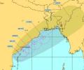
A cyclonic circulation lies over the southeast Bay of Bengal and the adjoining south Andaman Sea extending up to middle tropospheric levels. Under its influence, a low pressure area is very likely to form over the southeast Bay of Bengal and neighbourhood during the next 24 hours.

Heavy rains battered the coastal areas of north Tamil Nadu on Wednesday as cyclone 'Laila' further intensified and moved to lay centered in the Bay of Bengal around 190 km east-northeast of Chennai and is expected to cross the Andhra Pradesh coast on Thursday.
As many as 57 villages were marooned and 60 mandals were affected. As many as 33,570 families were affected out of whom 9,257 families were evacuated and lodged in 31 relief camps.
The strong wind that is expected may cause damage to thatched houses, uproot trees and disrupt power supply and communication network in coastal Orissa and neighbouring AP.

'There's also a possibility of the cyclonic system changing its course, thus avoiding a landfall in Odisha'

The IMD has warned of squally winds speed reaching 45-55 kmph gusting to 65 kmph likely to commence along and off Odisha and north coastal Andhra Pradesh coasts from October 27 onwards.
The depression, which was initially over west-central Bay of Bengal and adjoining areas, moved westward and intensified into a deep depression.
Heavy rainfall coupled with gusty surface wind is likely to pound some parts of Odisha as the deep depression over west-central Bay of Bengal intensified into a cyclonic storm 'ROANU' on Thursday.
The IMD has also issued a red-coded warning alert to the Odisha and West Bengal coasts.

no flight will depart or arrive at the Kolkata airport between 9.30 pm of May 3 and 6 pm of May 4

The India Meteorological Department said rainfall would be accompanied by gale wind speed reaching 140 to 150 kmph and gusting to 165 kmph along and off Odisha and north Andhra Pradesh coasts.

Chief Minister Jayalalithaa announces Rs 4 lakh compensation for the kin of dead.

According to the SRC, the evacuation of eight lakh people is the largest-ever evacuation operation in the country.