'When we talk of disaster, it is a combination of hazard and vulnerability.'
'If we reduce vulnerability, it will remain a hazard.'

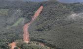
The devastating rain over Kerala's Kottayam and Idukki districts may have relented, allowing rehabilitation efforts to be undertaken, but with predictions of another two days of torrential rain, the people of Kerala are waiting with bated breath.
It is ironical that a populace which has always had a romance with the monsoon is now on tenterhooks every time there is cloud cover on the horizon.
According to the state disaster management authority, the toll from rain-related incidents has climbed to 38 since October 12 while the scale of destruction in terms of property and agriculture is yet to be estimated.
In an interview with Rediff.com Contributor Sujit Chandra Kumar, Dr M G Manoj, a researcher at the Advanced Centre for Atmospheric Radar Research, Cochin University of Science and Technology, discusses the reasons for nature's fury and possible solutions.
Not long ago, we were promoting monsoon tourism in Kerala. Now there is a scare every time it rains heavily. How did things come to such a pass?
It is true that we were trying to promote tourism during the monsoon and we may continue to do so.
But there has been a paradigm shift in the situation since August 2018.
The main reason for this is that the pattern of rainfall has changed significantly in the state, say in the last four years.
Tourists usually prefer to go near the rivers, waterfalls and mountainous regions and this is now definitely a risky proposition.
I would recommend that people should visit such places only after finding out from the authorities if red or orange alerts have been issued.

So, there a fundamental shift in the rainfall pattern in Kerala?
Yes, there is a change in the cloud structures.
Generally, during the monsoon, we have nimbostratus clouds, which are medium type clouds that can produce rains almost uniformly and continuing for two or three days.
In the recent years, these nimbostratus clouds are still there, but among them, in certain regions, there are also very deep ones known as cumulonimbus clouds.
These are clouds that grow vertically up to 17 kilometres above the ground and cause intense rain, thunder and lightning.
These were unusual earlier in Kerala during the monsoon season.
Now it is becoming more common. Typically, we witness fewer days of rain but torrential downpour within a short time.
Cumulonimbus clouds are usually seen during the pre-monsoon months of March, April and May and during the post-monsoon season from October to December.
From June to September, these were rare, but now we see their increased presence.
Earlier, we used to witness such clouds in the Konkan region but now they are shifting towards the south.
This is the main reason why we have flash floods and landslides now.

What are the possible reasons for such a shift?
For clouds to form, you need energy at the sea surface.
For deep convection, you need huge amount of thermal energy.
And, this energy is derived from the heat content of the ocean water.
By utilising the energy, the water gets evaporated, is lifted up and condenses to become water.
There has been a rise in the temperature level in the Arabian Sea.
Over a century, there has been an increase of at least 1 degree celsius in the temperature level there; it is now at 28 degrees on an average while it was 27 earlier.
What this clearly points towards is the possibility of climate change as a result of global warming.
I don't think we need to search for evidence on climate change, it is already at our doorstep.
Global warming is no science fiction, but a fact of life.
Its relevance can be understood from the fact that the latest Nobel Prize in physics was awarded to two scientists who were pioneers in making us understand the phenomenon of climate change and the role of human activities that contribute to it.
It is true that we need long-term data to assert that there is climate change.
Short term fluctuations are termed as climate variability.
But I feel that what we are witnessing now is an early indication of a lasting change.
Are these changes not reversible?
Some are reversible while the damage caused to certain ecological systems is irreversible.
We don't have much control over cyclones, for instance, but we do have a big role to play in disaster management, with advance warning systems and timely evacuation of people.
When we talk of disaster, it is a combination of hazard and vulnerability.
If we reduce vulnerability, it will remain a hazard.
Coordinated efforts such as demolishing constructions in fragile areas and afforestation can help to a certain extent.

Even laymen have observed that the water level during flooding is higher than earlier times. And that it is a result of water outlets and drainage systems getting blocked.
On the one hand, the flooding is triggered by intense rainfall and cloudburst, but the problem is amplified because of the unscientific land use pattern.
Natural streams and channels have been blocked while the width of the rivers, channels and drainage systems has come down.
Reduction in the area of wetlands and marshlands and paddy fields have also contributed to the flood risk.
People are throwing bottles and garbage into the drainage system, thereby blocking it.
We often say that rivers have memories.
They may have changed their course and people would have built houses or shopping complexes in those abandoned areas.
During a flood situation, water has a way of regaining its lost place, or to put it poetically, 'its ancestral home'.
The solution is to do river mapping or draw up a flood zonation map which identifies the spots where flooding happened previously.
In fact, cautionary boards should be erected in these places to avoid construction or unscientific agricultural activity and serve as a reminder.
Quarries also pose a threat.
While we can't say that quarries should not be allowed at all, we should at least follow all the regulations that exist with regard to their setting up.
Allow them, but only in safer zones.
We should also keep in mind that Kerala ranks third in the country with regard to population density.
While 380 is the national average, as per the last census, we have a figure of 850, almost two-and-a-half times more.
So, it becomes impractical to rehabilitate all those in affected areas.
We don't have vacant land like in other states and every inch is utilised.
So, vulnerability reduction is a greater challenge for us.
But then, while it is not possible to evacuate people from all the regions, we can identify areas that are most vulnerable and relocate them.
We need to start mass awareness campaigns that start at the school level about such vulnerability.
Protecting and respecting Mother Earth should become a habit like washing hands after a meal.

Have there been studies specifically done in this region to understand climate variations? What are the key findings?
Several research papers have been published about such changes over Kerala, Western Ghats, Bay of Bengal, Arabian Sea and so on.
As I said, over the last century, the Arabian Sea has warmed by more than 1 degree Celsius, on an average.
The intensity and frequency of devastating cyclones have also increased.
The belief that Kerala is a cyclone-free zone is slowly getting changed with the passage of Ockhi in 2017 and Touktae in 2021.
I have already pointed that modest rainy days are decreasing and heavy rain-filled days are increasing.

Certain areas like Manimalayar had even more rainfall this time than in 2018.
In 2018, rains were not so intense in the Kottayam region as much as in the Peerumedu region.
In 2019, it was more in Malappuram and Kozhikode.
In 2020, it was in Kannur and Kasaragod.
So, there were rapid shifts in maximum rainfall zone every year.
And that depends on several factors such as wind, atmospheric instability, etc.
What this means is that we could expect such heavy rains anywhere in Kerala.
Feature Presentation: Aslam Hunani/Rediff.com


 © 2025