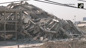
'Areas within 100 km of the landfall could suffer catastrophic effect.'

Air Vice Marshal G P Sharma (retd), President (Meteorology and Climate Change), Skymet, discusses with Prasanna D Zore/Rediff.com what is likely to happen before and after Cyclone Biparjoy makes landfall in Kutch on June 15.
What's the current status of Cyclone Biparjoy and where and when is it likely to make a landfall?
Currently, it is a very severe cyclonic storm. Earlier, it had intensified into an extremely severe cyclonic storm.
Whenever any storm has winds in excess of 167 km/hour, it becomes extremely severe. This particular storm had at one time winds to the tune of about 200 km/hour around its centre, which has now reduced because the sea temperature is reducing.
Therefore, Biparjoy's intensity and speed is also reducing now. Still, it's a very severe cyclone storm.
As a geographical phenomenon, decrease in temperatures reduces the intensity of these cyclones. Lesser the temperature, lesser the heat potential and that decays (reduces the intensity) the cyclone.
Now, as it moves northward, particularly towards Pakistan, the temperatures there are also rather low. But since it is moving very closely along Saurashtra and the Kutch coast, their temperatures are dropping all right, but not very significantly.
There will be a drop of about one to two degrees and from 32 degrees possibly then (at the time of landfall) the temperature will come down to about 30 degrees.
When Biparjoy crosses the Kutch coast and makes landfall it will be one grade lower from a very severe cyclonic storm to a severe cyclonic storm.
Even severe cyclonic storms have wind speeds of more than 100 km/hr associated with it and therefore, along with the torrential rains and high wind speed its damaging potential becomes very high.
Given such high wind speeds it can impact geographical areas that are farther away from the coast in the hinterland.
Closer to the coast (along the Kutch region) the damage potential is higher.
Areas within 100 km of the landfall could suffer catastrophic effect resulting in damage to old and dilapidated buildings, structures, thatched huts are likely to collapse; communication connectivity gets affected; results in flooding and water logging when storm surges go very high and astronomical tides (high tides caused due to gravitational pull of the moon, sun and earth) become higher and higher resulting in about 15 to 20 feet higher waves.
Where and when is it likely to make landfall?
Most likely it will begin its journey towards the (Kutch) coast on the morning of June 15 and by noon or 1.15 pm on Thursday it is going to make landfall in Kutch hitting vulnerable pockets close to Nalia and the Jakhau port.
If one has to talk about a little bigger zone, then the areas between Mandvi (Kutch's southern tip) to Lakhpath (Kutch's northern tip), the landfall will most likely be between these two places in the Kutch region with Jakhau port likely to be worst hit.
South of Mandvi, the Gulf of Kutch separates Kutch from Saurashtra region.
Jamnagar, Okha, Morbi, etc lie to the southern side of the Gulf of Kutch; Mumbai, Surat are very far away from the landfall area and will witness no damage of impact of Cyclone Biparjoy.
Apart from some strong monsoon showers (in regions south of Saurashtra), there will be no impact at all.
Nothing will happen in Surat. Nothing will happen in Mumbai. Northern side of Saurashtra and Gulf of Kutch and Kutch region will be impacted by this storm.
Southern parts of Saurashtra that include Somnath, Mahua, Veraval, Diu and coastal parts of Surat, Valsad, Bharuch and Vapi will face no damage at all.
How powerful will Cyclone Biparjoy be when it makes landfall? What will be its wind speed?
It will be termed possibly a severe cyclonic storm (when it makes landfall), in which case, wind speeds will be to the tune of about 100 km/hour plus.
There will be strong gusty winds in the range of 100-130 km/hr when it begins its journey towards the land in the early morning of June 15 and continue for the next about six to eight hours beyond afternoon.

What precautionary measures must be implemented in the event of such a cyclone, days before it makes landfall?
You have to safeguard all your assets, human lives and property.
Vulnerable people from vulnerable pockets will have to be taken to safer places, to shelters a little far away from the landfall for safety reasons.
People staying in weak structures like old buildings, huts, shanties, kutcha houses are likely to face the major brunt of the cyclone due to heavy rains, strong tides and gusty winds.
Provisions to repair and erect communication and connectivity infrastructure soon after the intensity of the cyclone ebbs will need to be taken care of quickly.
Telecom towers and other telecommunication infrastructure will no doubt face a severe brunt of such high winds.
Snapped power lines and grids will need to be restored quickly even as machines to cut and transport uprooted trees on major roads will have to be cleared quickly for bringing back some normalcy.
Provisions to safeguard critical power and telecom infrastructure as well as clear water logging in low-lying areas and roadways will have to be done so that relief could be provided to those affected without wasting much time.
What precautions should people living in the affected areas take after the cyclone makes landfall and weakens thereafter?
You have to wait for some time before the flood waters recede; astronomical tides will be witnessed between Mandvi and Lakhpat by 11 am on June 15, which coincides with the time of landfall.
Astronomical tides will be above normal at this time as they will be in association with the tropical storm resulting in higher waves. This will cause inundation and flooding of low-lying areas reaching deep inside (in the areas away from the coast).
That is why those people have to be evacuated and taken to far away safe places, safe shelters.
Even after the storm moves away, it leaves lot of problems, lot of connectivity gets disrupted.
Many trees will have fallen, live (electric) wires could be strewn around, transmission lines will have been damaged, roads connectivity will take a beating; transportation will be in disarray, though there is not much rail network in place in Kutch.


 © 2025