By 2017 monsoon, IMD would have a model to warn civic authorities about rain over a specific area to prevent disasters, reports Sanjeeb Mukherjee
India Meteorological Department is planning to expand its operations from only providing weather and climate updates to focus on issuing warnings on disasters and developing a calamity-management system.
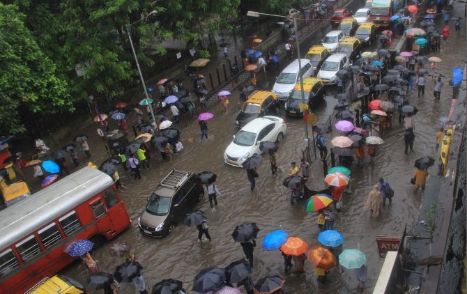
With floods in cities becoming regular -- last year in Chennai; this year in Pune, Bengaluru and Gurgaon -- and throwing life out of gear, the Met department is developing a model to predict the exact amount of rain over small areas, at least four to six hours before the actual downpour.
The localised predictions would help civic bodies, traffic police and rescue teams prepare for eventualities such as waterlogging and traffic snarls, said the new IMD Director General K J Ramesh.
At present, the Met department provides information and warning on hotspots in a severe weather situation.
But, it is often unable to provide exact information on the exact amount of rain over a localised area.
Also, even if the information is provided, it often fails to raise the flags with local authorities.
“We already have data on rainfall through satellite imagery, Doppler and weather radars and advanced warning systems.
"What we need is to put this information on a model to know the exact quantum of rain over a highly localised area,” Ramesh, who has a long experience in disaster management, told Business Standard.
Explaining how the model will work, Ramesh said: “Suppose we can predict the exact amount of rain over Lajpat Nagar, a residential area in south Delhi, over the next four to six hour.
"If, in turn, the civic authorities can tell us how much water the drain can flush out in that time, we will know immediately if the area will be flooded when it pours.”
The director general, who took charge last week, added: “If this is known and all the civic services are on alert, it will be possible to check damage and limit the inconvenience to the people.”
At present, though the vulnerable spots are known, the quantum of rain that might occur is not known.
This leads to chaos and mismanagement.
The new model disaster-impact forecast system for big cities would be prepared, starting with the National Capital Region, by the monsoon next year.
The IMD has already started discussing the plan with various civic and municipal bodies and will use the platform of the National Disaster Management Authority to develop this system.
The Met department has also written to government of coastal states to give them details of infrastructure, types of houses, crops sown and their acreage, kind of power transmission lines and communication infrastructure for cyclone- and hurricane-prone areas.
Once this information is available, the IMD plans to prepare a comprehensive impact-assessment report on cyclones for each state.
So, when a cyclone actually hits, the authorities are prepared to prevent losses.
“Weather and climate hazards are part and parcel of our lives and we have to live with them because of growing impact of climate change, but what we can do is to built maximum resistance so that loss to life and physical infrastructure is minimum,” Ramesh said.
HOW IT WORKS
- Met department will predict the exact amount of rain over a localised area, such as Lajpat Nagar in south Delhi
- Civic authorities would provide information about drainage capacity in the area, making it clear if it would flood
- Emergency services can be on standby to prevent disasters or inconveniences to people
DEADLINE: Monsoon 2017
PILOT: New Delhi
ALLIES
IMD is working with civic bodies, National Disaster Management Authority
PLANS FOR COASTS
Met department to write to coastal states seeking information about infrastructure and to provide advance cyclone predictions


 © 2025