 | « Back to article | Print this article |
PICS: STUNNING Mars landscapes from NASA
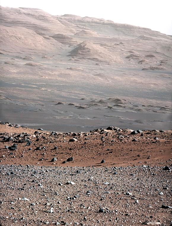
Mars' Mount Sharp -- the rover's eventual science destination -- is pictured in photo taken by the Curiosity rover. The image is from a test series used to characterise the 100-millimeter mast camera on NASA's rover.
Photograph: Reuters/NASA
Click on NEXT to see more PHOTOS...
PICS: STUNNING Mars landscapes from NASA
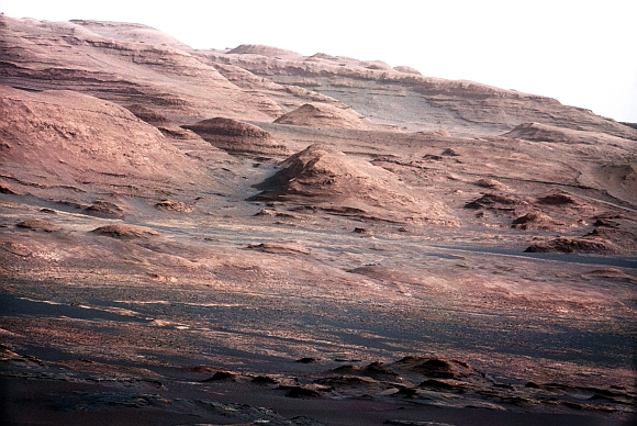
The base of Mars' Mount Sharp -- the rover's eventual science destination -- is pictured in this photo taken by the Curiosity rover.
Scientists enhanced the color to show the Martian scene under the lighting conditions we have on Earth, which helps in analysing the terrain.
Photograph: Reuters/NASA
Click on NEXT to see more PHOTOS...
PICS: STUNNING Mars landscapes from NASA
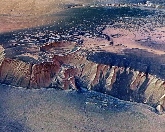
A cliff, up to 4,000 metres high, located in the eastern part of Echus Chasma, one of the largest water source regions on Mars, is seen in this image taken by the high-resolution stereo camera on board European Space Agency 's Mars Express.
Echus Chasma is the source region of Kasei Valles which extends 3,000 km to the north.
Photograph: Reuters/NASA
Click on NEXT to see more PHOTOS...
PICS: STUNNING Mars landscapes from NASA
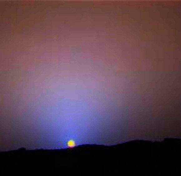
A close-up of the sunset on Sol 24 as seen by the Imager for Mars Pathfinder was released by the Jet Propulsion Labratory.
The red sky in the background and the blue around the sun are approximately as they would appear to the human eye but the color of the sun itself is not correct -- the sun was overexposed in each of the 3 color images that were used to make the picture.
The true color of the Sun itself may be near white or slightly bluish.
Photograph: Reuters/NASA
Click on NEXT to see more PHOTOS...
PICS: STUNNING Mars landscapes from NASA
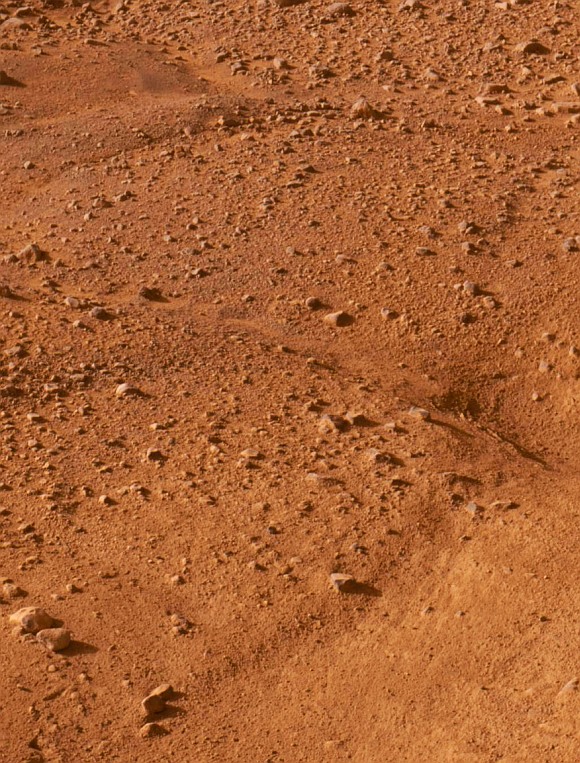
One of the first color images from the Phoenix Mars Lander shows the surface of Mars after the Phoenix Mars Lander spacecraft landed successfully in the first-ever touchdown near Mars' north.
Photograph: Reuters/NASA
Click on NEXT to see more PHOTOS...
PICS: STUNNING Mars landscapes from NASA
The High-Resolution Stereo Camera on board ESA's Mars Express has returned images of Echus Chasma.
Echus Chasma is an approximately 100 km long and 10 km wide incision in the Lunae Planum high plateau north of Valles Marineris, the 'Grand Canyon' of Mars.
Photograph: Reuters/NASA
Click on NEXT to see more PHOTOS...
PICS: STUNNING Mars landscapes from NASA
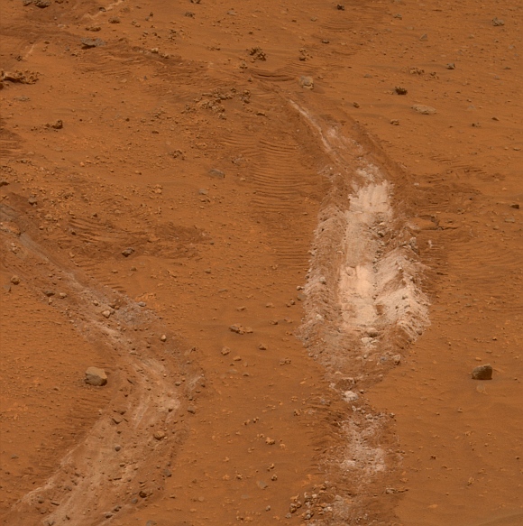
A view of a path of soil discovered by NASA's Mars Exploration Rover Spirit that scientists said on suggests that long ago hot springs may have percolated on the Martian surface, providing an environment quite conducive to life, is seen.
The rover Spirit, exploring the expansive Gusev Crater just south of the Martian equator, detected a patch of light-colored soil that was 90 per cent pure silica, an indicator of the past presence of water, scientists said.
Photograph: Reuters/NASA
Click on NEXT to see more PHOTOS...
PICS: STUNNING Mars landscapes from NASA
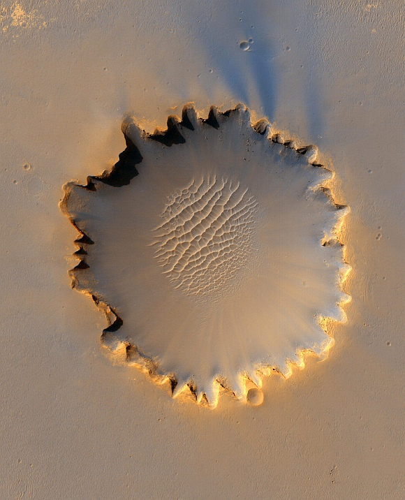
Mars' Victoria Crater at Meridiani Planum is seen in this image taken by NASA's High Resolution Imaging Science Experiment camera.
NASA officials gave conflicting views during a meeting of space scientists, on whether the construction of a moon base will mark a great leap in planning for a manned mission to Mars or prove a wasteful diversion of funds.
Photograph: Reuters/NASA
Click on NEXT to see more PHOTOS...
PICS: STUNNING Mars landscapes from NASA
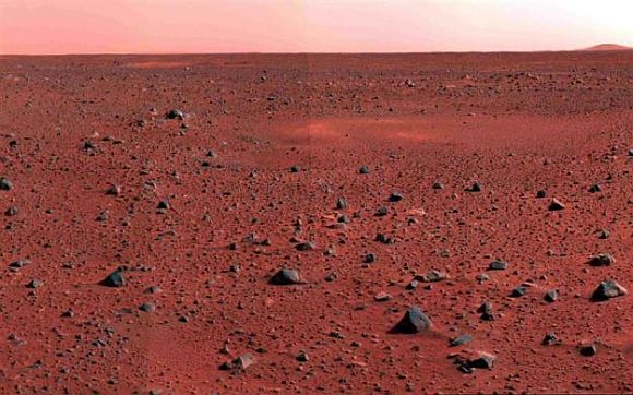
A January 2004 image mosaic taken by the Mars Exploration Rover Spirit's panoramic camera shows a slice of martian real estate southwest of the rover's landing site.
Photograph: NASA/JPL/Cornell
Click on NEXT to see more PHOTOS...
PICS: STUNNING Mars landscapes from NASA
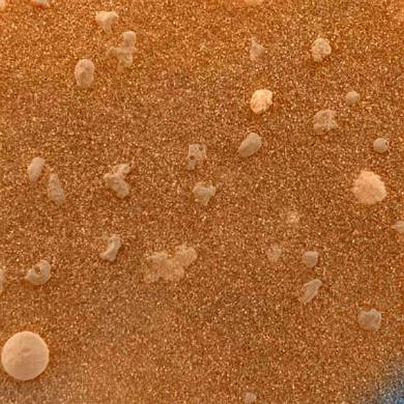
A magnified look at the martian soil near the Mars Exploration Rover Opportunity's landing site, Meridiani Planum, shows coarse grains sprinkled over a fine layer of sand, February 2004.
The image roughly approximates the color a human eye would see.
Click on NEXT to see more PHOTOS...
TOP photo features of the week
Click on MORE to see another set of PHOTO features...
