 | « Back to article | Print this article |
In PHOTOS: Google snaps Iranian nuclear sites
Search giant Google has released satellite images of facilities at two Iranian cities that the United Nations claims may be used to develop nuclear weapons.
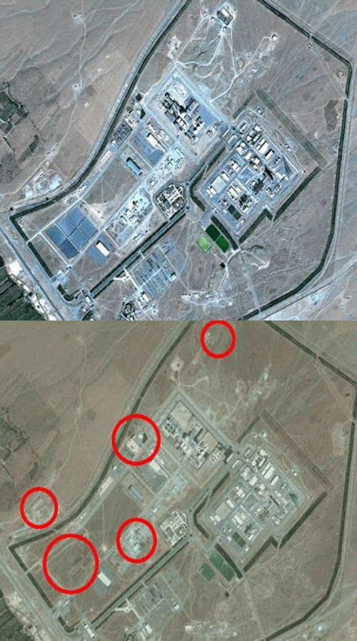
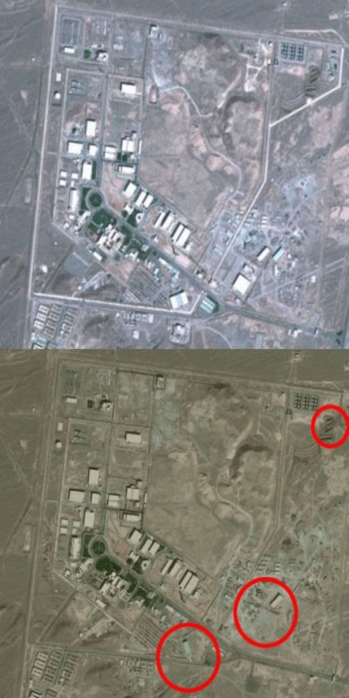
Recent satellite images of Arak and Natanz show changes to the facilities when compared with images taken in October 2010.
Google released the overhead pictures in the wake of a report by UN nuclear watchdog, International Atomic Energy Agency (IAEA), that expressed 'serious concerns regarding possible military dimensions to Iran's nuclear programme,' the Daily Mail reports.
Click on NEXT to see the other nuclear site....
In PHOTOS: Google snaps Iranian nuclear sites
Natanz, which features a Fuel Enrichment Plant and Pilot Fuel Enrichment Plant at its site, has been described as 'the facility at the heart of Iran''s dispute with the UN'.
It is also thought to be the largest nuclear facility in Iran, and has anti-aircraft weapons to defend itself from potential airstrikes.
The town of Arak is home to a heavy-water production plant, which can be used to generate nuclear power.
According to the paper, the IAEA report stated that the agency requested further access to the plant in August, but did not receive a response from Iran, forcing it to monitor the facilities from the air via satellite imagery.
Click on MORE to see realted PHOTO FEATURE....

