 | « Back to article | Print this article |
 US satellites are being used to gauge groundwater use in India and the observations are worrying, according to a report published in sciencemag.org.
The report notes, 'For the first time, satellite remote sensing of a 2000 km swath running from eastern Pakistan across northern India and into Bangladesh has put a solid number on how quickly the region is depleting its groundwater.'
'The number is big, says hydrologist James Famiglietti of the University of California, Irvine -- big as in 54 cubic km of groundwater lost per year from the world's most intensively irrigated region hosting 600 million people.'
'I don't think anybody knew how quickly it was being depleted over that large an area.'
The big picture of Indian groundwater comes from the Gravity Recovery and Climate Experiment satellite mission, launched in March 2002 as a joint effort by the US National Aeronautics and Space Administration and the German Aerospace Centre.
According to the sciencemag.org report, India is depleting groundwater by about 54 billion cubic meters (BCM, same as cubic km used in the report) per year.
Himanshu Thakkar, expert on water and rivers, says, "We should be very worried about the groundwater depletion and the fact that we are doing practically nothing either to stop destruction of groundwater recharge systems or regulate groundwater overexploitation through community lead mechanisms, as decentralised source and resource use entity like groundwater cannot be regulated through any centralised systems. Our knee jerk reactions in times of drought could prove even more costly, in fact."
The article warns that groundwater is not bottomless. Thakkar says, "When we would hit the bottom, the situation would get very scary."
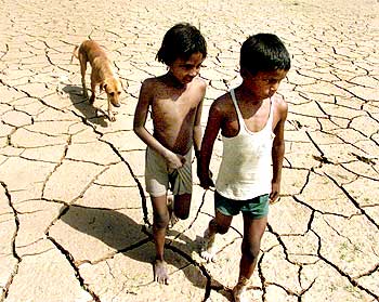
Image: Children walking with a stray dog along a parched field
Reportage: A Rediff Correspondent | Photograph: Ajay Verma/Reuters