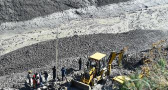
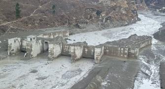
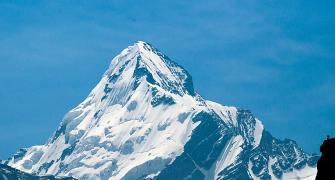
'Above 2,000 metres the gradient of the Himalayas is very steep and if you build any infrastructure (roads, dams, hydro power projects) in these regions, it will not be able to sustain these events (the onslaught of debris that comes down with great speeds).'
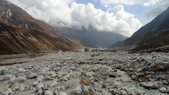
Dr Pradeep Srivastava, a scientist at the Wadia Institute of Himalayan Geology based in Dehradun, Uttarakhand, has spent decades studying the geology and sedimentation in the Himalayan mountain ranges.
Dr Srivastava speaks to Prasanna D Zore/Rediff.com on the causes behind the February 7 flash floods in Chamoli, how sensitive the Himalayas are to construction activities, and how various government-funded expert agencies could come together to design and build environmentally sustainable infrastructure projects in this ecologically fragile belt.
How do you look at the avalanche and floods caused by breaking of a glacier at Chamoli in Uttarakhand? Was this expected?
Actually, these are the areas where we do not have any vegetation, rocks are open and these rocks frequently undergo freezing and thawing.
Over the last several days we have improved our understanding of how the events unfolded. None of the scientists are able to go to Ground Zero because of the rescue operations and the debris on the path there.
Remote sensing imagery and other data available indicate the combination of a rock fall, or a major landslide that occurred over the crown of the glacier.
So it was the rock fall that triggered the event and then it disturbed the hydrology of the glacier mass that then created the debris flow.
It came down with great speed because of the high gradients in these regions.
The event may have been expected or otherwise, but the phenomenon is very natural because of the basic geology of the Himalayas and the nature of the melting glaciers.
The Nanda Devi hill ranges have so many glaciers and it was reported by one of the scientists of the Wadia Institute of Himalayan Geology that these glaciers are receding at unprecedented rates (due to warming) as global glacial records are showing.
When the glaciers recede they also thin vertically and when they thin down, they form so many larger and smaller lakes.
Due to this phenomenon, this area is already vulnerable; not only Nanda Devi, but laterally all across the Himalayas, where the elevations are above 2,000-2,500 metres the areas are vulnerable.
The June 2013 Kedarnath tragedy also occurred due to a lake breach, and the debris that it carried along with it was flowing at great speeds due to the high gradient system.
Above 2,000 metres the gradient of the Himalayas is very steep and if you build any infrastructure (roads, dams, hydro power projects) in these regions, it will not be able to sustain these events (the onslaught of debris that comes down with great speeds).
Though such events (lake breach, rocks falling on glaciers and causing them to break apart) are natural they become disastrous when combined with human interfaces (activities like construction of dams, roads, deforestation).
How common are these phenomena in the entire Himalayan mountain ranges and why don't these kind of disasters happen frequently if they are so common?
As I said, the disaster has a human element to it. Large parts of higher Himalayas are still wilderness. As you move up above Joshimath, you won't find any human settlements there; the population starts thinning down. So even if such events keep happening they don't shape into a disaster.
We as geologists have studied nearly 40 such events over the past 1,000 years that have caused large, extreme floods. There are geological records of these events happening across Ladakh, the Brahmaputra valley, suggesting these activities are natural and have been happening in the past too.
In the recent past, we had a similar kind of event in 1893 when Dhauli Ganga above Chamoli was blocked by a major landslide during heavy rains and that led to formation of a lake called Gohna and this lake was breached in 1970 leading to devastation of Srinagar (a city in Pauri Garhwal district of Uttarakhand) and Haridwar.
Then again a similar activity occurred in 2013 and now in 2021. In between there were several events of cloudburst when smaller villages were destroyed. If you remember, in Parvati in Himachal Pradesh, several people had died because of similar kind of event and the collapse of a small hydropower project.
So, any hydropower projects built above the 2.000-metre elevation are not able to sustain themselves when these kind of events strike.
Many times, these structures themselves are not disastrous, but they are unable to withstand these events and sometimes compound or amplify problems.
In the 2013 Kedarnath tragedy the waters from the Vishnuprayag project added to the flood volume and sediments. Several small dams were washed away and compounded the problem.
In 2021, though there were several commissioned dams (in the region that witnessed flash floods) they didn't add to the disaster because they are still under construction (they didn't hold water).
Another important thing to remember is that such events are climatically controlled. They become more frequent when warming occurs.
For instance, Kedarnath, which at present has frigid kind of climate conditions, was a marsh land 400-800 years ago, according to geological records. Polle of sunflower and rice were found in these areas then.
There are evidences that suggest that climate has warmed in the past when there wasn't much human (industrial) activity. So, there is a natural climatic cycle also that keeps on varying with time depending on the sun-earth geometry.
Today, while climatic conditions, more or less, continue with their natural cyclic domain, we have started planning our infrastructure (in these areas). That interface is becoming disastrous today.
What was the immediate cause of this glacial outburst at Joshimath?
To be very specific, this event cannot be categorised as a glacial outburst.
It was a rock fall that hit the crown of the glacier; glaciers have a valley and valley walls, which are rocky. So it was a rock that collapsed and fell over a glacial mass that created the debris flow.
What caused the rocks to break?
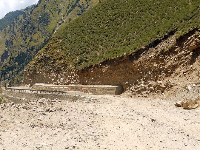
Rocks in the Himalayas, since they have risen to this elevation of 6,000 metres, are technically disturbed, folded, faulted and they have several sets of fractures.
Due to the presence of these folds, faults and fractures, these rocks are already tectonically or structurally deformed.
When you have naturally occurring fractures at these elevations and when snowfall occurs it melts down and enters these fractures.
When the water in these fractures freezes, it further widens the fractures. Continuous process of freezing and thawing occurs in these areas because of large differences in day and night temperatures.
This kind of extreme temperature variation occur normally during pre-monsoon time, or when you are at the fag end of winters; warming starts picking up, summers start setting in and day temperatures rise to 10-15 degrees and nights are around minus 10 degrees.
This valley (where the rocks fell on the glacier near Joshimath) is east-west trending allowing direct exposure to the sun the whole day.
North-facing glaciers will not be seeing any sunlight; south-facing glaciers will be seeing sunlight all the day.
These are some of the heterogeneties which come into picture ,but in this case (the Chamoli flash floods); we believe that it was a rock fall that occurred due to mechanical weathering.
How frequently could we see this type of events going ahead?
This is a matter of predictive model. But going ahead annual temperatures will rise; our average annual temperature will rise to about 1.5 degrees by 2050 and based on these facts we believe that glaciers will be melting down, mountainous rocks will be exposed more and more (to freezing and thawing, and hence breaking apart due to mechanical weathering) and things could change dramatically, may be resulting in more devastation if we are not prepared.
What preparation do you think we need to undertake to avoid extensive damage to human lives, property and environment?
Government has several agencies of its own, like the Wadia Institute of Himalayan Geology, National Hydrology Institute, Central Building Research Institute, Central Road Research Institute, which have subject matter expertise. All the IITs have science and civil engineering departments.
My humble suggestion is whenever any major infrastructure has to come up (in ecologically fragile ones) or our government is planning, then all these agencies should come together on the table, with every agency offering its own expertise and should offer a studied, well-researched opinion on whether such projects should be allowed to go ahead or not and the government should strictly adhere to the recommendations and opinions of this expert committee.
It is not that we are against anything (infrastructure projects undertaken by the government in such fragile zones); the only thing is this we are trying to impart our knowledge (for everybody's safety) and, in fact, we are funded by the government.
I believe that all such agencies should come together on one platform.
Were any warnings or alerts given to the government by any of these agencies before all these project were commissioned and construction activities began on dams across not only rivers in Uttarakhand but also across the Himalayan range?
2013 was a huge learning experience for all the scientists in every sphere working in the Himalayas.
In all the reports we gave, we suggested that above 2,500-metre elevation there should be very little infrastructure, or planned infrastructure.
After that (the Kedarnath tragedy of 2013) there were directions from the Supreme Court that all the construction of dams above this elevation (2,500-metre) should be stopped.
There is something called as main central thrust (a major geological fault).
MCT is a tectonic discontinuity in Himalayas above which the Himalayas rises at a rapid rate and this is the thrust where most of the earthquakes occur and above this (elevation) the Himalayan topography rises dramatically and the hill slopes are more than 35 degrees, 40 degrees, and 60 degrees making them steeper.
The river systems are very high gradient systems and they are very erosive because of which we have gorges there.
We recommended that we should not be building too much of infrastructure in these zones.
Another was monitoring (of glaciers). But monitoring the Himalayas is a big task because the Ganga Basin itself has 968 glaciers. How many (of these glaciers) can you monitor?
The Himalayas have a full gradient of climate and tectonics; the western part of the Himalaya is dry and the eastern part of Himalaya is very wet. There are four major basins: the Indus, the Ganga, the Tista and the Brahmaputra basin.
These basins also cut across the Himalayan north-south and cover the whole monsoon spectrum.
We believe that all government agencies having expertise in various related fields in the Himalayas should be able to study and give the complete picture of the hydrology, earthquakes zones, and these kinds of disasters, but for this we need at least 10 to 15 years of data.
And that commitment needs bigger, trained manpower, lot of supercomputers, artificial intelligence and large data handling. This commitment has to come from the government because everything comes at a cost.
Until you are ready to spend the money and give the necessary incubation time (to these expert agencies), to be decided by scientists only, things won't work out; the targets can be given by administrators. (If we get all these, then) I believe we should be able to analyse and monitor these events over the longer-term and generate enough data about such events.
Like, if a landslide occurs, we will be able to find out what climatic conditions caused them, what were the prevailing geological conditions, etc.
If we are monitoring these events all 365 days, then we will be able to tell the threshold or say when the rocks actually fell, when the landslide occurred.
And then if we have similar kind of events analysed, studied and recorded over several past years, we will be able to train our computers, using artificial intelligence, using the studied set of conditions to figure out if particular climatic conditions could result in any disaster and what should be our response in the event of such a landslide, avalanche or flash flood occurring.
For doing this we (the scientists, geologists, hydrologists, etc.) will need large data sets. But that requires bigger infrastructure and dedicated institutions.
So far in India we do not have any dedicated institution that actually monitors the Himalayas. We do not have Himalayan-centric institutions; the Himalayas are a global entity, a very young one at that and it has changed the global monsoon system, global ocean chemistry; it (the formation of Himalayas) was so dramatic.
But we do not have any institution focusing only on the Himalayas. A person who is trained in IIT Madras, or IIT Kanpur, may not have seen the Himalayas and understand the relief and topography of the Himalayas. These people (may not be competent enough) to decide upon the designs and structures (of the dams) that could be built across different regions of the Himalayas.
To overcome these limitations, we need to have more Himalayan-centric institutions that should teach Himalayan sciences. We need an IIT kind of institution specially to study the Himalayas which could be set up across all the states through which the Himalayan ranges pass.
(At present), we (in Uttarakhand) are not talking to Himachal Pradesh. The ministry of earth sciences will never talk to the ministry of forests. We do not have any interface even across related ministries.
We need a pan-Himalayan integrated approach and at the same time we need institutions that are experts in solving the problems and challenges that the Himalaya poses.
Now it is a matter of time when we will start seeing regular floods in Himalayas; if you are a good administrator then you should be planning today to manage today and also what could happen in the next 50 years and beyond.
The bridge that was washed away was made by the best of the engineers of the BRO (Border Roads Organisation). Still, it was washed away.
We need lot of expert brains working together to produce out-of-box engineering solutions for the Himalayan region.

