 | « Back to article | Print this article |
'Flooding and rains will be there but since it will be a moving system, it will be a shifting pattern, it will not be persisting for long'

"I expect very heavy rainfall at some places in Uttar Pradesh and Bihar along with sub-Himalayan West Bengal comprising of Alipurduar, Cooch Behar, Darjeeling, Kalimpong, Siliguri, Jalpaiguri, including Sikkim, parts of Arunachal Pradesh, and parts of lower Assam, Rangia downward like Barpeta, Goalpara, Dhubri along with parts of Meghalaya," Air Vice Marshal G P Sharma (retd), President, Meteorology and Climate Change, Skymet Weather Services, tells Prasanna D Zore/Rediff.com.
However, Mumbai and adjoining areas, including the Konkan belt, can heave a sigh of relief as "we should be having better weather conditions and as we progress towards the end of the week it should ease out further," says AVM Sharma, who also explains in detail why Mumbai witnessed a heavy spell recording 286 mm of rainfall in about 24 hours.
Could you explain the weather pattern and the disturbance it has caused over Mumbai as well as adjoining areas leading to heavy rains?
Actually the rains started last evening (September 22) onwards; it has been pouring only in the night. But today (September 23), I will say turned out to be much better than what happened during the night and early morning (of September 23).
Till yesterday evening, Santa Cruz recorded about 16 millimeters, whereas in the 24 hours since then it was recorded about 286 millimeters.
I think it should resolve shortly now and the worst is over for this spell. We should be having better weather conditions and as we progress towards the end of the week it should ease out further. No heavy rains are expected for the later part of the week.
What explains this weather pattern? We had very short but heavy spells of rains since the evening of September 22?
Mumbai gets rains either when weather systems form in the Bay of Bengal and from that time onwards the surge starts building or when anytime you have Southwesterly winds coming from Arabian Sea towards the Ghats, where the mountain ranges vary in height from 3,000 feet to 6000 feet, which is ideal height to cause orographic clouding and give rains.
As soon as this system forms the surge starts, meaning winds begin to flow from high pressure areas to low pressure areas or depressions. Winds always blow from high pressure areas to low pressure areas.
So, when the winds from the sea side, from the Mumbai side, Maharashtra side, start building up and rush towards the (western) ghats, because of the low pressure in the hinterland this winds move inside towards Odisha, Chhattisgarh, or Madhya Pradesh.
As the winds enters the hinterland, that is the time rains pick up over Mumbai, over Konkan. But this phenomenon as such is very peculiar to Mumbai.
Additionally, we had the second supplementary feature that was circulation (of winds) over southern parts of Gujarat coast in the Arabian Sea.
The combination of these two (systems) led to formation of a sheer line running very close to Mumbai; whenever you have the reversal of the winds, like if you easterly winds on this side and westerly winds on the other side, and in between if you draw a line, you call it a sheer line.
Whenever such situation arises and if it extends for longer distances you say that a sheer line is extending from so and so place to so and so place.
So, the combination of that sheer line along with circulation caused multiple systems (leading to heavy showers over Mumbai and adjoining areas).
Since this is time of withdrawal of monsoon, they (the monsoon winds) don't go deep into Rajasthan but would be recovering and going to parts of southwest UP (Uttar Pradesh) and adjoining areas from this position. Obviously, we expect it (the spell of rains over Mumbai and adjoining areas) to ease out.
Which parts of India are likely to get heavy showers in the coming days?
I expect very heavy rainfall at some places in Uttar Pradesh and Bihar along with sub-Himalayan West Bengal comprising of Alipurduar, Cooch Behar, Darjeeling, Kalimpong, Siliguri, Jalpaiguri, including Sikkim, parts of Arunachal Pradesh, and parts of lower Assam, Rangia downward like Barpeta, Goalpara, Dhubri along with parts of Meghalaya.
Are these regions likely to experience floods in the coming days?
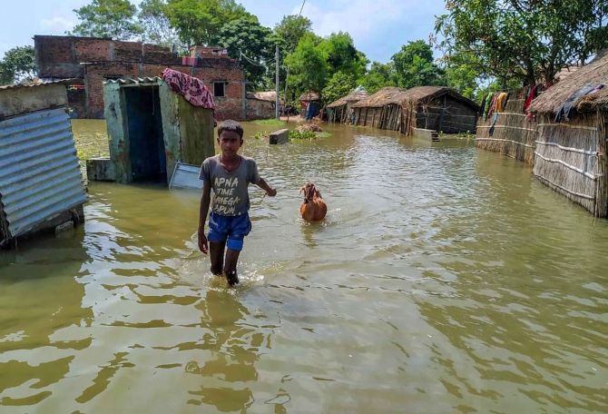
Flooding and rains will be there but since it will be a moving system, it will be a shifting pattern, it will not be persisting for long; it would last for maximum of two days.
There has been a break for (rains) for the last two weeks. I don't think the terrain and the adjoining parts will get saturated enough to cause rains and floods for longer duration.
Floods happen if it rains continuously for days together, or the terrain gets saturated, or if it (the deluge) comes from Nepal side, from the hills.
There will be heavy rains; there will be very, very heavy rains also along foothills of mountain ranges in Uttar Pradesh, and in Bihar.
In Uttar Pradesh we will see heavy to very heavy rains right from Bareilly, Pilibhit, Hardoi, Bahraich, going downwards right up to even Gorakhpur, then shift to Bihar in Siwan Gopalganj, Sitamarhi, Madhepura, Supaul, Araria, Kishenganj, Purnea, Bhagalpur, in the next few days.
So, the weather pattern that we saw in Mumbai is not unusual?
Last year, it was horrible in the month of September. Nothing has happened this time (compared to the rains last year). It was terrible last time.
It was an all-time record in the month of September 2019. This is the first spell of September 2020 in Mumbai and possibly this will be the last now.